Silviculture Services
We offer a complete package of Silviculture Services
WHAT WE OFFER
Silviculture Consultancy
GEOTREE offers a comprehensive woodland management service across the island of Ireland, with a strong focus on native woodland restoration and creation.
Mapping
Certified Species Maps
Biodiversity Maps
Fencing Maps
Forest Roads Planning, Mapping & Application
Consultancy and Supervision
Woodland Maintenance
(Urban & Rural)
Grant Application with The Dept of Agriculture, Food & Marine (DAFM)

Continuous Cover Forestry (CCF)
GEOTREE will accurately collect data that can be used to make important decisions relating to planting and harvesting.
Data such as soil analysis, foliar analysis and ecological reports can be used to help choose the correct species to plant in your woodland in order to ensure that your woodland thrives with the right tree in the right place.
In Ireland there are two main types of silviculture systems that are used to manage forests, 1: Clearfell System, 2: Continuous Cover Forestry(CCF) or otherwise known as ‘close to nature’ system.
Continuous cover forestry (CCF) is a broad term covering an array of silvicultural methods where the objectives are to permanently retain some form of canopy or forest presence. One of the primary methods used to achieve CCF is through shelterwoods systems.
Establishing shelterwoods involves creating clearings throughout the woodland (no bigger than 0.25 ha). Within these openings, seed trees would be selected to allow the re-establishment of a future crop with natural regeneration or, in most cases, the open areas would be re-planted with trees and guards.


Figure 1
GEOTREE Ltd is focused on close to nature silviculture methods of Woodland management.
Woodland management for biodiversity and selective thinning that provides for regeneration of new trees. GEOTREE Ltd believes in the principles of ‘Sustainable Forestry Management’.
This principle is centred around the idea of managing a woodland/forest for Social –Ecological – Economic benefits.
With this principle the rational is that everyone benefits and the woodland can continue to grow and provide a continuous benefit long into the future see Fig 1.
GIS Accurate Data Collection
GEOTREE Ltd delivers accurate, science-based tree data supported by comprehensive maps, created by a qualified and experienced cartographer.
Field data is collected using state-of-the-art GNSS equipment with centimetre-level accuracy, then organised and presented as comprehensive, accurate maps through Geographic Information System (GIS) technology, available in both digital and hard copy formats.
GIS methodology organises and categorises data into intuitive 'layers,' providing a clear and client-friendly way to present complex information.


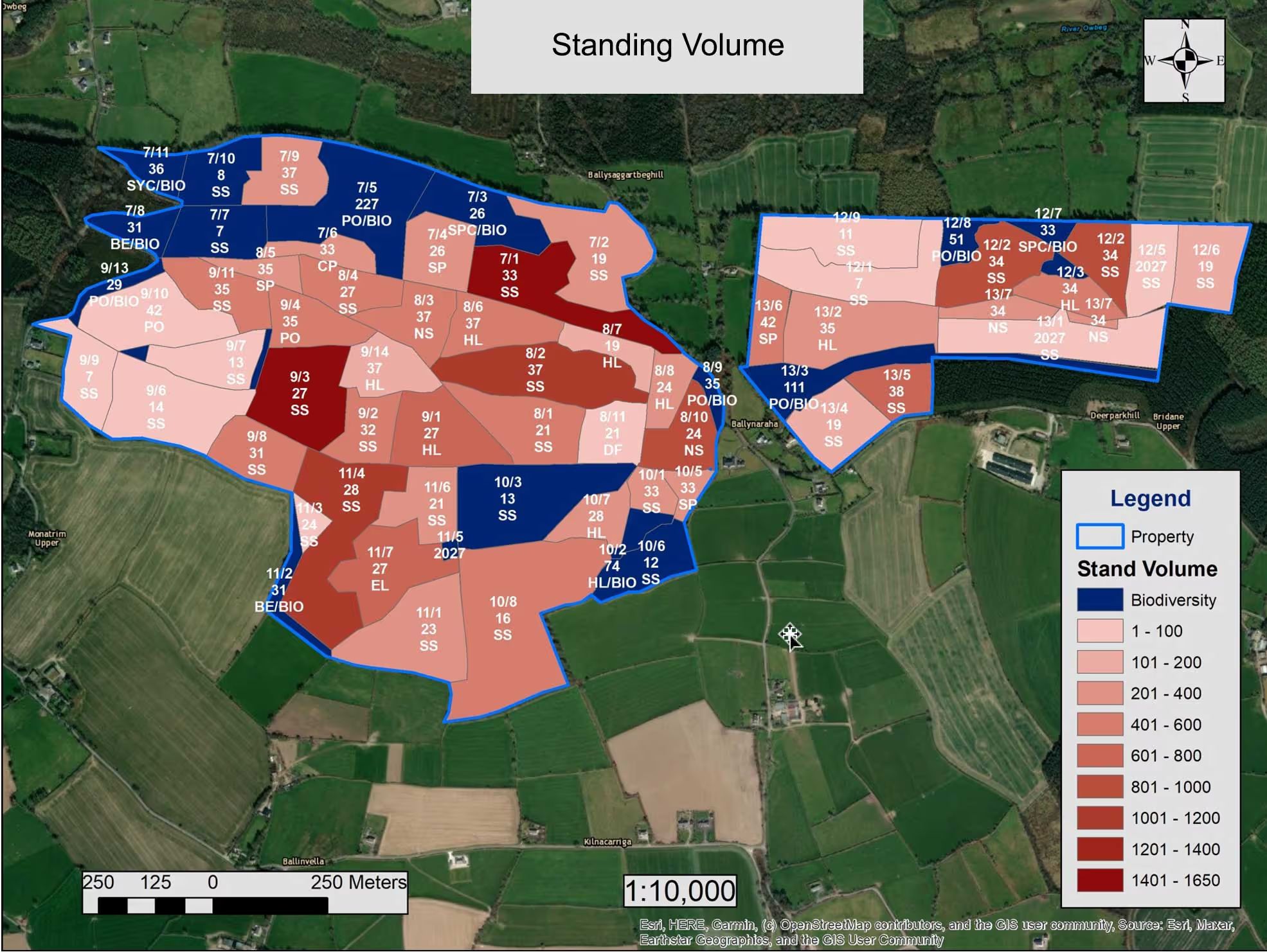


This approach supports effective tree management and planning processes. Key benefits include:
Categorisation of Data:
Layers can separate information such as species type, age, and condition, making it easy to interpret.Enhanced Visualisation:
Management strategies and priorities are illustrated through layered maps, offering a clear understanding of on-the-ground conditions and proposed methodologies.Integration Capabilities:
Data can be merged into topographical surveys and architectural drawings, supporting planning applications and the development of comprehensive management plans.
