Arboriculture Services
We offer a complete package of Arboricultural Services
WHAT WE OFFER
Tree Survey BS5837:2012
Urban forestry generally involves arboricultural practices. It might involve the management of trees on a more individual basis or in small groups as opposed to rural type of forestry management that requires silvicultural methods of tree management on a larger scale.
The components that make up a standard BS5837 Tree Survey for Planning & Development are as follows:
BS5837: 2012
Trees in relation to Design, Demolition and Construction

This is a table displaying the data gathered during your BS5837 tree survey. Click the table for large version.

Tree Classification Schedule
For each tree, the following are included: age, species, dimensions, condition, life expectancy, defects, recommendations and most importantly the BS 5837 Retention Category. Each tree will also be displayed as a scaled diagram so that readers can see at a glance which are the important trees and which ones are relatively insignificant.
The BS5837 tree survey and report enables architects to design around the tree constraints which will help get your project off to a good footing but will not be enough to validate your planning application on its own. For that you will also need a detailed and supportive Arboricultural Impact Assessment.
Arboricultural Impact Assessment
This gives an overview of the site and general tree condition.
Attention is drawn to trees identified during the tree survey to be potentially hazardous or having a particularly high amenity value. Site-specific constraints are discussed. Advice is given as to how to maximise the development potential of your site without harming trees that the planners will want to see retained.
We also undertake a search to determine if any trees are the subject of a Tree Preservation Order, or whether your site is within a Conservation Area.


Tree Constraints Plan
This is a CAD drawing indicating tree position, crown spread, colour-coded BS5837 Retention Category, shade constraints and the all-important BS5837 Root Protection Areas.
Its purpose is to enable intelligent design which takes into account the tree constraints that your local authority will be interested in.
We will provide you with copies of the Tree Constraints Plan in whatever formats you prefer – PDF, DWG and/or paper copies.
Arboricultural Method Statement
Once proposals have been finalised, the local authority may require a detailed Arboricultural Method Statement before they will discharge planning conditions.
Adherence to an Arboricultural Method Statement will ensure contractors do not accidentally damage trees during construction.
Affordable, robust mitigation measures should be specified that will take into account budgetary constraints and the practical needs of the contractor, whilst safeguarding important trees.
Installation of underground and over-ground service
Sympathetic road construction techniques
Protective fencing specification
Land regrading
Necessary tree pruning
Storage of materials and siting of cabins
Handling of materials hazardous to tree health
Movement of heavy machinery and soil compaction

The Tree Protection Plan
This important drawing accompanies the Arboricultural Method Statement.
It identifies areas where mitigation measures are required and specifies restricted activities in these zones.
These restrictions will ensure the project runs smoothly without inadvertently damaging trees.
Geotagging
Geotagging enables precise geographic tagging or pinpointing of individual trees or groups of trees, providing accurate GPS coordinates.
These coordinates are typically presented in the Irish Transverse Mercator (ITM) or World Geodetic System(WGS84). Detailed data for each tree can be collected, stored, and accessed offline, ensuring flexibility and reliability. All survey points are displayed on a GIS-based map, offering a clear visual representation.
Additionally, this data can be exported to other formats, such as Google Earth, for enhanced usability and integration with other platforms.

GIS Accurate Data Collection
GEOTREE Ltd delivers accurate, science-based tree data supported by comprehensive maps, created by a qualified and experienced cartographer.
Field data is collected using state-of-the-art GNSS equipment with centimetre-level accuracy, then organised and presented as comprehensive, accurate maps through Geographic Information System (GIS) technology, available in both digital and hard copy formats.
GIS methodology organises and categorises data into intuitive 'layers,' providing a clear and client-friendly way to present complex information.


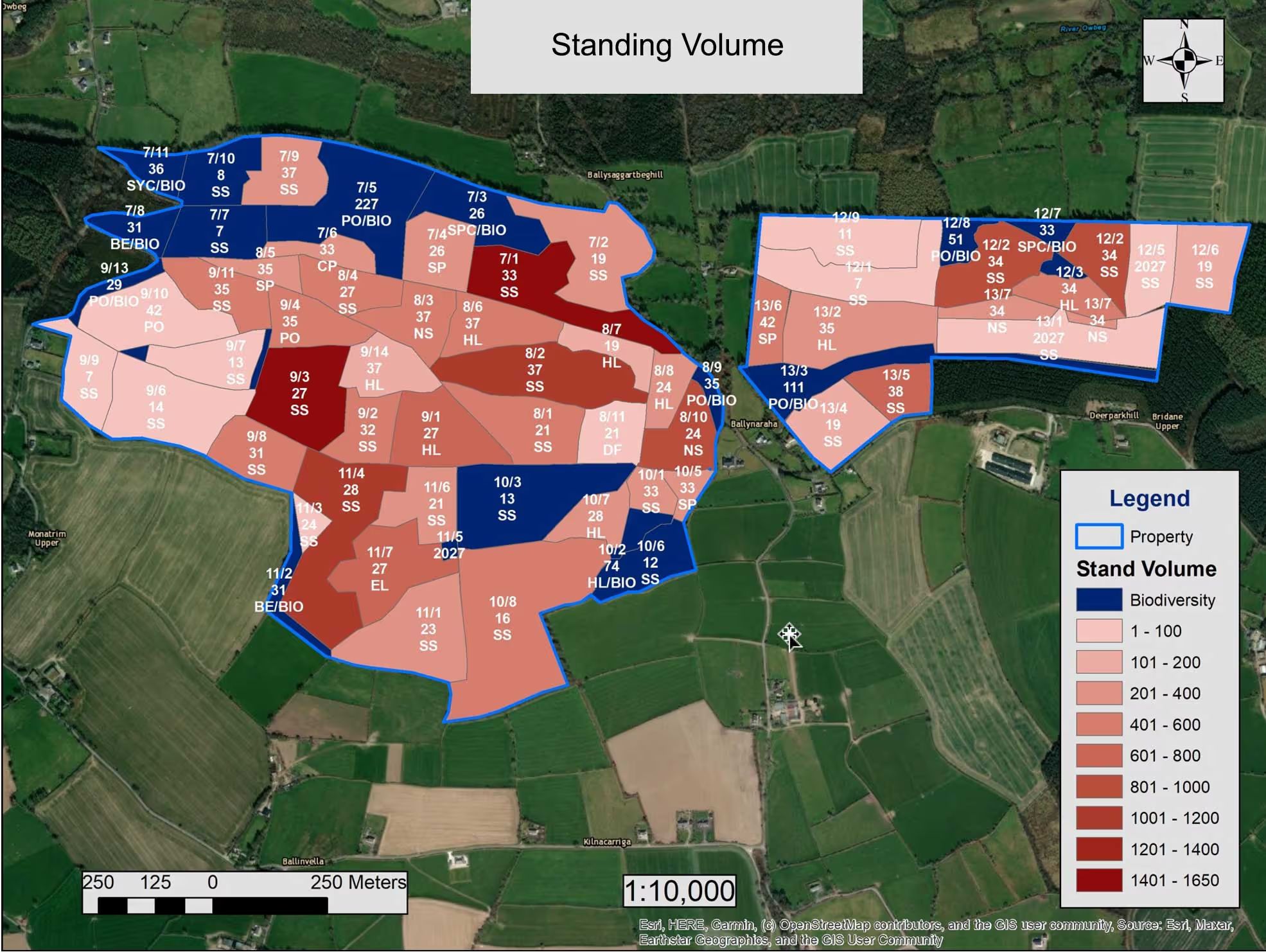


This approach supports effective tree management and planning processes. Key benefits include:
Categorisation of Data:
Layers can separate information such as species type, age, and condition, making it easy to interpret.Enhanced Visualisation:
Management strategies and priorities are illustrated through layered maps, offering a clear understanding of on-the-ground conditions and proposed methodologies.Integration Capabilities:
Data can be merged into topographical surveys and architectural drawings, supporting planning applications and the development of comprehensive management plans.
